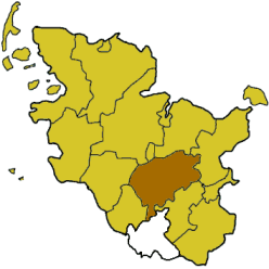
Circondario di Segeberg
circondario tedesco
Il circondario di Segeberg (in tedesco Kreis Segeberg) è uno dei circondari del Land tedesco dello Schleswig-Holstein.
| Circondario di Segeberg circondario | |
|---|---|
| (DE) Kreis Segeberg | |
| Localizzazione | |
| Stato | |
| Land | |
| Distretto | Non presente |
| Amministrazione | |
| Capoluogo | Bad Segeberg |
| Territorio | |
| Coordinate del capoluogo | 53°56′12″N 10°18′15.51″E |
| Altitudine | 37 m s.l.m. |
| Superficie | 1 344,4 km² |
| Abitanti | 280 400[1] (31-12-2021) |
| Densità | 208,57 ab./km² |
| Altre informazioni | |
| Fuso orario | UTC+1 |
| ISO 3166-2 | 01 0 60 |
| Codice Destatis | 01 0 60 |
| Targa | SE |
| Cartografia | |
 | |
| Sito istituzionale | |
Geografia antropica
modificaSuddivisioni amministrative
modifica(Tra parentesi i dati della popolazione al 31 dicembre 2021[1])
- Città e comuni non appartenenti a comunità amministrative
- Bad Bramstedt, città (15 149)
- Bad Segeberg, città (17 529)
- Ellerau (6 308)
- Henstedt-Ulzburg (28 182)
- Kaltenkirchen, città (23 191)
- Norderstedt, città (80 420)
- Wahlstedt, città (9 958)
- Comunità amministrative (* = Sede amministrativa)
- Alveslohe (2 786)
- Hartenholm (1 930)
- Hasenmoor (743)
- Lentföhrden (2 651)
- Nützen* (1 240)
- Schmalfeld (1 955)
- 2. Amt Bad Bramstedt-Land
[Sede: Bad Bramstedt]
- Armstedt (377)
- Bimöhlen (1 020)
- Borstel (132)
- Föhrden-Barl (295)
- Fuhlendorf (409)
- Großenaspe (2 989)
- Hagen (491)
- Hardebek (487)
- Hasenkrug (364)
- Heidmoor (299)
- Hitzhusen (1 247)
- Mönkloh (244)
- Weddelbrook (1 046)
- Wiemersdorf (1 685)
- Boostedt* (6 443)
- Daldorf (635)
- Groß Kummerfeld (1 878)
- Heidmühlen (669)
- Latendorf (622)
- Rickling (3 183)
- Bornhöved (3 356)
- Damsdorf (224)
- Gönnebek (509)
- Schmalensee (500)
- Stocksee (409)
- Tarbek (166)
- Tensfeld (677)
- Trappenkamp* (5 248)
- 5. Amt Itzstedt
- Itzstedt* (2 488)
- Kayhude (1 234)
- Nahe (2 543)
- Oering (1 422)
- Seth (1 912)
- Sülfeld (3 289)
- Tangstedt (6 479) (appartenente al circondario di Stormarn)
- 6. Amt Kisdorf
- Hüttblek (374)
- Kattendorf* (849)
- Kisdorf (3 949)
- Oersdorf (888)
- Sievershütten (1 095)
- Struvenhütten (983)
- Stuvenborn (857)
- Wakendorf II (1 360)
- Winsen (364)
- 7. Amt Leezen
- Bark (991)
- Bebensee (655)
- Fredesdorf (437)
- Groß Niendorf (676)
- Högersdorf (406)
- Kükels (445)
- Leezen* (1 775)
- Mözen (457)
- Neversdorf (706)
- Schwissel (256)
- Todesfelde (1 093)
- Wittenborn (995)
- 8. Amt Trave-Land
[Sede: Bad Segeberg]
- Bahrenhof (204)
- Blunk (574)
- Bühnsdorf (365)
- Dreggers (46)
- Fahrenkrug (1 598)
- Geschendorf (573)
- Glasau (872)
- Groß Rönnau (553)
- Klein Gladebrügge (555)
- Klein Rönnau (1 806)
- Krems II (388)
- Negernbötel (1 011)
- Nehms (582)
- Neuengörs (809)
- Pronstorf (1 626)
- Rohlstorf (1 213)
- Schackendorf (904)
- Schieren (264)
- Seedorf (2 212)
- Stipsdorf (247)
- Strukdorf (269)
- Travenhorst (210)
- Traventhal (534)
- Wakendorf I (493)
- Weede (1 025)
- Wensin (873)
- Westerrade (449)
Note
modificaAltri progetti
modifica- Wikimedia Commons contiene immagini o altri file su circondario di Segeberg
Collegamenti esterni
modifica- (DE) Sito ufficiale, su segeberg.de.
| Controllo di autorità | VIAF (EN) 129018983 · LCCN (EN) n81124406 · GND (DE) 4054215-4 · J9U (EN, HE) 987007559605305171 |
|---|

