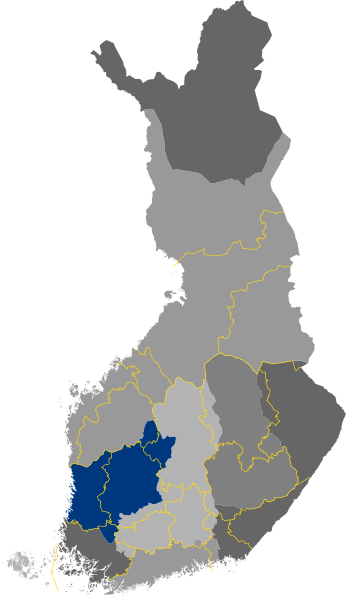
File:Historical province of Satakunta, Finland.svg

Dimensioni di questa anteprima PNG per questo file SVG: 346 × 599 pixel. Altre risoluzioni: 138 × 240 pixel | 277 × 480 pixel | 443 × 768 pixel | 591 × 1 024 pixel | 1 182 × 2 048 pixel | 1 675 × 2 901 pixel.
File originale (file in formato SVG, dimensioni nominali 1 675 × 2 901 pixel, dimensione del file: 449 KB)
Cronologia del file
Fare clic su un gruppo data/ora per vedere il file come si presentava nel momento indicato.
| Data/Ora | Miniatura | Dimensioni | Utente | Commento | |
|---|---|---|---|---|---|
| attuale | 15:22, 25 dic 2020 |  | 1 675 × 2 901 (449 KB) | Fenn-O-maniC | Updated |
| 07:36, 12 ago 2020 |  | 244 × 428 (49 KB) | Fenn-O-maniC | Reverted to version as of 20:04, 7 August 2020 (UTC) | |
| 19:29, 11 ago 2020 |  | 244 × 428 (1,33 MB) | Bflagge | Artjärvi. | |
| 14:08, 11 ago 2020 |  | 244 × 428 (1,33 MB) | Bflagge | Hamina and Kotka situate in the area of the Uusimaa historical province. | |
| 21:04, 7 ago 2020 |  | 244 × 428 (49 KB) | Betelgeuse X | Updating the border of historical Karelia. The River Kymi formed the boundary between the Häme Finns and the Karelians during the middle ages [1][2]. In the 15th and 16th centuries this tribal border was further confirmed, with Naulasaari serving as the meeting point of the borders of Häme, Savo, and Karelia. Sources [1] "Ancient Karelia" Uino, Pirjo. p118 [2] "Erämaat, Asutus ja Olot" Jalkanen, K.J. p2 | |
| 17:40, 23 giu 2020 |  | 244 × 428 (53 KB) | Fenn-O-maniC | Updated borders | |
| 22:17, 11 nov 2013 |  | 244 × 428 (52 KB) | Wikiotr | User created page with UploadWizard |
Pagine che usano questo file
La seguente pagina usa questo file:
Utilizzo globale del file
Anche i seguenti wiki usano questo file:
- Usato nelle seguenti pagine di en.wikipedia.org:
- Usato nelle seguenti pagine di en.wiktionary.org:
- Usato nelle seguenti pagine di es.wikipedia.org:
- Usato nelle seguenti pagine di fi.wikipedia.org:
- Usato nelle seguenti pagine di zh.wikipedia.org:
