File:Map of the Hauran (satellite version)-it.svg

Dimensioni di questa anteprima PNG per questo file SVG: 647 × 581 pixel. Altre risoluzioni: 267 × 240 pixel | 535 × 480 pixel | 855 × 768 pixel | 1 140 × 1 024 pixel | 2 281 × 2 048 pixel.
File originale (file in formato SVG, dimensioni nominali 647 × 581 pixel, dimensione del file: 2,66 MB)
| Questo file e la sua pagina di descrizione (discussione · modifica) si trovano su Wikimedia Commons (?) |
Dettagli
| Descrizione |
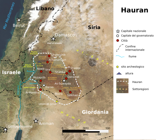
English: Map of the Hauran (satellite version)
Italiano: Mappa della regione Hauran (versione satellitare) |
||
| Data | |||
| Fonte |
Opera propria basata su: Map of the Hauran (satellite version).svg: |
||
| Autore |
|
||
| Altre versioni |
|
||
| SVG sviluppo | Questa mappa in grafica vettoriale è stata creata con Inkscape.
|
.svg)
-it.svg)
-it.svg?uselang=it)
-it.svg)
-it.svg&action=edit)
Licenza
Questo file è disponibile in base alla licenza Creative Commons Attribuzione-Condividi allo stesso modo 4.0 Internazionale
- Tu sei libero:
- di condividere – di copiare, distribuire e trasmettere quest'opera
- di modificare – di adattare l'opera
- Alle seguenti condizioni:
- attribuzione – Devi fornire i crediti appropriati, un collegamento alla licenza e indicare se sono state apportate modifiche. Puoi farlo in qualsiasi modo ragionevole, ma non in alcun modo che suggerisca che il licenziante approvi te o il tuo uso.
- condividi allo stesso modo – Se remixi, trasformi o sviluppi il materiale, devi distribuire i tuoi contributi in base alla stessa licenza o compatibile all'originale.
Registro originale del caricamento
This image is a derivative work of the following images:
- Map of the Hauran (satellite version).svg licensed with Cc-by-sa-4.0
- 2024-02-22T12:34:06Z Arrow303 647x581 (2981351 Bytes) w/o border
- 2024-02-22T12:32:12Z Arrow303 648x581 (2981686 Bytes) some technical fixes
- 2019-09-12T17:25:00Z Amitchell125 649x579 (4783724 Bytes) minor corrections
- 2019-09-12T07:57:30Z Amitchell125 649x579 (4779327 Bytes) Improved accuracy and readability
- 2019-09-09T22:57:09Z Amitchell125 649x579 (4787682 Bytes) correction
- 2019-09-09T22:42:56Z Amitchell125 649x579 (4787599 Bytes) User created page with UploadWizard
Uploaded with derivativeFX
Cronologia del file
Fare clic su un gruppo data/ora per vedere il file come si presentava nel momento indicato.
| Data/Ora | Miniatura | Dimensioni | Utente | Commento | |
|---|---|---|---|---|---|
| attuale | 15:48, 10 dic 2024 | | 647 × 581 (2,66 MB) | אורי9 | File uploaded using svgtranslate tool (https://svgtranslate.toolforge.org/). Added translation for he. |
| 15:32, 10 dic 2024 |  | 647 × 581 (2,65 MB) | אורי9 | File uploaded using svgtranslate tool (https://svgtranslate.toolforge.org/). Added translation for he. | |
| 15:32, 10 dic 2024 |  | 647 × 581 (2,65 MB) | אורי9 | File uploaded using svgtranslate tool (https://svgtranslate.toolforge.org/). Added translation for he. | |
| 15:30, 10 dic 2024 |  | 647 × 581 (2,64 MB) | אורי9 | File uploaded using svgtranslate tool (https://svgtranslate.toolforge.org/). Added translation for he. | |
| 14:17, 22 feb 2024 |  | 647 × 581 (2,62 MB) | Arrow303 | colors | |
| 14:12, 22 feb 2024 |  | 647 × 581 (2,62 MB) | Arrow303 | == {{int:filedesc}} == {{Information |Description={{en|1=Map of the Hauran (satellite version)}} {{it|1=Mappa della regione Hauran (versione satellitare)}} |Source={{Derived from|Map of the Hauran (satellite version).svg|display=50}} |Date=2024-02-22 |Author= * File:Map of the Hauran (satellite version).svg: Amitchell125 * {{author|derivative|{{u|Arrow303}}}} |Permission= |other_versions={{G|Map of the Hauran (satellite... |
.svg)
Pagine che usano questo file
Le seguenti 3 pagine usano questo file:
-it.svg)