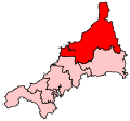
File:NorthCornwall2007Constituency.svg

Dimensioni di questa anteprima PNG per questo file SVG: 207 × 193 pixel. Altre risoluzioni: 257 × 240 pixel | 515 × 480 pixel | 824 × 768 pixel | 1 098 × 1 024 pixel | 2 197 × 2 048 pixel.
File originale (file in formato SVG, dimensioni nominali 207 × 193 pixel, dimensione del file: 155 KB)
Cronologia del file
Fare clic su un gruppo data/ora per vedere il file come si presentava nel momento indicato.
| Data/Ora | Miniatura | Dimensioni | Utente | Commento | |
|---|---|---|---|---|---|
| attuale | 01:14, 17 giu 2008 |  | 207 × 193 (155 KB) | Wereon | == Summary == Map of the new UK Parliament constituency of North Cornwall. == Licensing == {{PD-self}} Category:Locator maps of parliamentary constituencies of Cornwall {{ImageUpload|basic}} |
Pagine che usano questo file
La seguente pagina usa questo file:
Utilizzo globale del file
Anche i seguenti wiki usano questo file:
- Usato nelle seguenti pagine di en.wikipedia.org:
- Bodmin
- Padstow
- Tintagel
- Camelford
- Wadebridge
- Davidstow
- North Petherwin
- Advent, Cornwall
- Altarnun
- Warbstow
- Egloshayle
- St Mabyn
- St Tudy
- St Issey
- St Teath
- St Minver
- St Eval
- Bude–Stratton
- Blisland
- Boyton, Cornwall
- Jacobstow
- Morwenstow
- Marhamchurch
- St Clether
- Lewannick
- St Ervan
- Whitstone
- Lesnewth
- St Juliot
- St Kew
- Laneast
- St Merryn
- Stoke Climsland
- Wikipedia:WikiProject Cornwall
- Wikipedia:WikiProject Cornwall/Templates
- Kilkhampton
- Cardinham
- Egloskerry
- Lanivet
- Helland
- Werrington, Cornwall
- St Breward
- St Endellion
- Michaelstow
- Withiel
- Launcells
- Wikipedia talk:WikiProject Cornwall/Archive 3
- Week St Mary
- North Hill, Cornwall
- St Gennys
Visualizza l'utilizzo globale di questo file.
