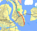
File:US 52 Spur.PNG
US_52_Spur.PNG (422 × 359 pixel, dimensione del file: 20 KB, tipo MIME: image/png)
Cronologia del file
Fare clic su un gruppo data/ora per vedere il file come si presentava nel momento indicato.
| Data/Ora | Miniatura | Dimensioni | Utente | Commento | |
|---|---|---|---|---|---|
| attuale | 02:26, 19 apr 2007 |  | 422 × 359 (20 KB) | Scgatorfan | Map of US-52 Spur in Charleston, South Carolina Map was downloaded from http://tiger.census.gov and modified to fit the format of the Wikipedia:WikiProject U.S. Roads/Maps task force. |
Pagine che usano questo file
La seguente pagina usa questo file:

